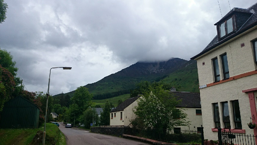
Sgorr Dhearg from Ballachulish.
Sgorr Dhearg
Meaning - Red Peak
Summit Location - NN05687, 55831
Height - 1024m
Munro Number - 107
Sgorr Dhonuill
Meaning - Peak of the Donalds
Summit Location - NN04064, 55530
Height - 1001m
Munro Number - 137
Distance - 11.4km (plus around 4km back along the road)
Total Ascent - 1339m
Time Taken - 3hrs to Sgorr Dhearg / 1hr to Sgorr Dhoniull / 2hrs down
Difficulty - 4/5
OS Explorer Map - 384
Climbed - 2014
Weather - Overcast cloud, though lifting and breaking up a little as the walk went
on. Dry and very warm.
The two peaks behind Ballachulish have to be among my favourite Munros in this part
of Scotland. They’re rather underrated given their more famous neighbours in nearby
Glen Coe. But these peaks have it all: great views from the top (particularly as
they’re so close to the coast), a great variety of terrain from some grade 1 scrambling
through to a pleasant stroll through pine forests and beside waterfalls in Gleann
a’ Chaolais.
This route described below begins in Ballachulish and ascends the northeast ridge
of Sgorr Dhearg, continuing to Sgorr Dhonuill before descending through the plantation
to South Ballachulish. The only issue is that this will leave you around 3km away
from the start, where you likely left your car. As this isn’t a particularly long
route you should have more than enough energy left for this final stretch. Alternatively
you may have some luck hitching a lift or you could, as I did, stash a bike at the
end of the walk.
The swift return to the car was important as I was taking advantage of the long summer
days by squeezing this walk into an afternoon - I’d driven up from England that morning.
Being the height of summer it was a fairly warm day, with the temperature in the
high 20s. It felt very hot climbing up onto the ridge - and the midges were out in
force too! Despite this I still found this a very enjoyable walk.
Route
1 - Start at the main car park in Ballachulish. Take the road into the village, past
the playing fields and then take the lane which leads towards the school. Continue
to the end of this lane, and then go through a gate into a meadow. There’s a path
but it’s muddy and not particularly well established. After a short while bear right
and ascend the ridge.
2 - After the 600m contour the ridge gets steeper and you’ll reach the section with
some scrambling. There’s some exposure but the moves are straightforward. Sticking
to the crest of the ridge is safest (and most fun). You’ll soon reach the subsidiary
peak of Stob Bhan, where you can put your hands back in your pockets. The ridge continues
easily to a bealach and then a short ascent take you to the summit of Sgorr Dhearg.
3 - From here, head west down a ridge to a bealach. Then continue in a westerly direction,
ascending a narrowing ridge to Sgorr Dhoniull. Route-finding is straightforward but
take care - steep ground is all around you, though it doesn’t feel particularly exposed.
You’ll soon reach the second Munro of the day.
4 - The descent begins at a gentle gradient as you walk in a westerly direction from
Sgorr Dhonuill. You’ll need to walk for just over a kilometre in this direction before
you can descend into Gleann a’ Chaolais because of very steep ground to your right.
In poor weather it might be tricky to spot the point where you can descend safely
as there isn’t much of a path. Check your map carefully - there is a gap in the crags
which offers a safe route.
5 - Descend more steeply into the glen. Lower down you should pick up a path which
leads pleasantly through pine forests and pasts streams and waterfalls. This path
then meets a vehicle track used by the logging trucks. You can follow these back
to the car park at South Ballachulish - the route is signposted.
6 - From the car park you can take the foot/cycle path to the road and then continue
east along A82 to reach Ballachulish.