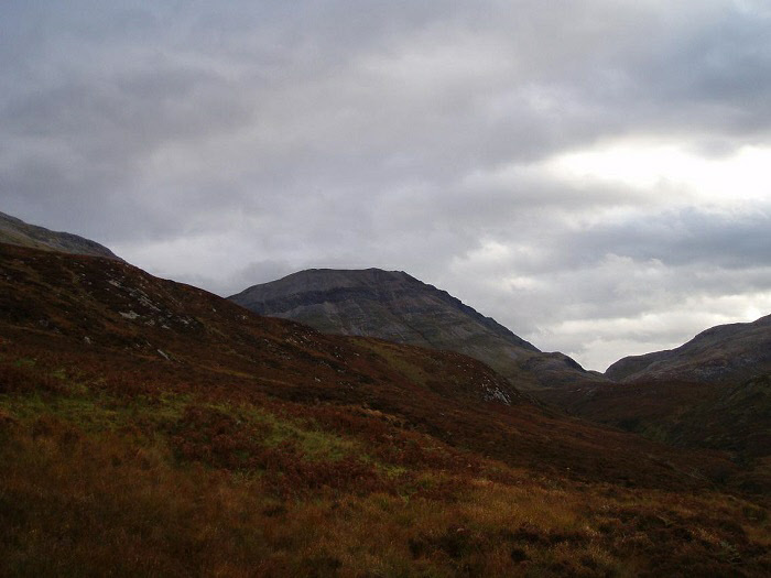
Conival from Gleann Dubh.
Conival
Meaning - Adjoining Hill
Summit Location - NC3031, 1994
Height - 987m
Munro Number - 158
Ben More Assynt
Meaning - Big Hill of Assynt
Summit Location - NC3181, 2017
Height - 998m
Munro Number - 141
Distance - 17.0km
Total Ascent - 1398m
Estimated Time - 7 hours.
Difficulty - 4/5
OS Explorer Map - 442
Being in the far north of Scotland, Conival and Ben More Assynt are invariably climbed
together. Conveniently, they are linked by a ridge so once you've climbed one there's
no more than 100m of re-ascent to bag the other. If thinking in Munro terms, these
mountains stand rather solitary, but given a clear day you'll be treated to a view
of the most magnificent mountain lanscape. Suiven, Quinag, Canisp to name but a few
of the mountains that rise practically vertically out of the sea. What they lack
in height they more than make up for in character. Some of the rocks in this part
of Scotland are some of the oldest in the world, being more than 3 billion years
old.
The remoteness of these hills means there's really only one route and that is from
the car park at Inchnadamph and then following the footpath up Gleann Dubh. This
route then takes a path north to the meet the northwest ridge of Conival. Once on
the summit you can follow the ridge east to Ben More Assynt. This ridge is not particularly
tricky although there are some places where care is required. Some of the ridge is
quite craggy and loose scree presents problems in some places, although it's not
unduly difficult.
Returning to Inchnadamph by the same route is the easiest way. The route down to
the loch from Ben More Assynt is very steep and not for the faint hearted. If you
prefer to do a circular route then it might be best climb these peaks in reverse
order. On the walk-in continue up Gleann Dubh and go through the Conival-Breabag
Tarsuinn pass to the loch and climb the southeast ridge of Ben More Assynt, continuing
on to Conival. This ridge is much narrower and more exposed than the one between
the two peaks though so do bear this in mind.
Whichever route you take don't forget to check out the Traligill Caves in Gleann
Dubh as you head home. Don't forget your torch!
It's worth mentioning also that winter conditions will make the ridges on this route
a much more demanding walk unless you've got some winter experience under your belt
already.
Route
1 - Start at the car park near the hotel in Inchnadamph. You need to walk north along
the main road for a short while, crossing over the bridge and then taking the vehicle
track toward the youth hostel and Gleann Dubh.
2 - The vehicle track continues to the cottage at Glenbain, where it then becomes
a footpath. Continue up into the Glen along this path. Where the path forks take
the route to the left to stay on the north side of the river.
3 - After about 2km the path turns to the north to climb beside the burn towards
the bealach between Beinn an Fhurain and Conival.
4 - After reaching the bealach you should take the rough path that climbs up the
northwest ridge of Conival. After the first 800m the ridge narrows and levels out
for the last 200-300m before the summit, which is marked with a small shelter.
5 - To continue to Ben More Assynt take the path to the east, descending steeply
to the ridge between the two mountains. Care should be taken at this point, the first
part in particular is quite craggy and there are some slippery scree slopes to negotiate.
6 - Ben More Assynt lies about 1km along the ridge. The second half of the ridge
is much easier than the first. On reaching the end of the ridge there appears to
be two peaks, either of which could be the summit. The north peak is in fact the
true summit and is marked with a cairn.
7 - The easiest route back would be to do a reverse of the route taken so far. The
initial difficulties on the ridge between the two Munros will be much easier in ascent.
Descending directly to the loch is not recommended as it is very steep and craggy.