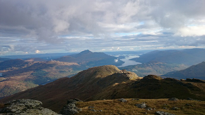
Stunning views of Loch Lomond from Ben Vorlich
Meaning - Mountain of the Bay
Summit Location - NN29498, 12457
Height - 943m
Munro Number - 229
Distance - 13.3km
Total Ascent - 1040m
Estimated Time - 4hrs (Beginner).
Difficulty - 2/5
OS Explorer Map - OL39
Ben Vorlich is the northernmost Munro of the Arrochar Alps, a group of mountains
to the West of Loch Lomond. It’s quite hard to see from the road, it’s steep sided
and the peak lies some way to the west. Those familiar with the drive up the A82
to the north west of Scotland will have probably seen the Inveruglas hydro-electric
power station. Water runs through pipelines from Loch Sloy, under Ben Vorlich to
the power station, which is close to the start of this walk.
The track to the Loch Sloy dam allows easy access to Ben Vorlich. The simplest way
to the peak will be to use this track in both ascent and descent, which is the route
described here. There is also the possibility to make a circuit, perhaps by ascending
the Little Hills of Ben Vorlich, to the east of the peak.
Note that the trig point on Ben Vorlich actually sits on a secondary peak 2m below
the true summit which is around 100m further north (and marked by a cairn).
Route
1 - Start at the car park at the visitor centre slightly to the north of Inveruglas
power station. Head south along the A82, passing the power station. You should use
the marked path on the west side of the road.
2 - After about 500m you will see a gate leading to a vehicle track which passes
under the railway. Take this track which climbs into the valley and then levels out.
Bear left at the first junction and right at the next two. If you’re on the right
trail you won’t cross Inveruglas Water.
3 - After about 3.5km on the trail, with the Loch Sloy Dam about 500m ahead, take
care to spot a small cairn to your right (it’s just after a small burn). This marks
the faint path that climbs up the southern slopes of Ben Vorlich.
4 - Follow this path, climbing steep slopes. The ground is quite wet and slippery
so take care. As you near the ridge the path veers left, close to some steep crags
so careful route-finding is needed. I also saw some holes between some of the rocks
so be careful where you place your feet!
5 - Once you’re on the ridge you’ve still got around 150m of ascent ahead of you,
but the terrain is much easier than the tricky slopes you’ve already ascended. A
well worn path leads to the summit.
6 - Note that the summit is around 100m north of the trig point, which sits on a
secondary top at 941m. This summit is marked with a cairn.
6 - Return by way of ascent, taking care on the steep, slippery slopes.