© Copyright Dominic Rhodes 2014-
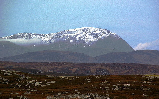
Ben Hope (photo credit Flickr user Paul Wordingham)
Meaning -
Summit Location -
Height -
Munro Number -
Distance -
Total Ascent -
Time -
Difficulty -
OS Explorer Map -
Climbed -
Weather: overcast at about 600m with showers of rain, one particularly heavy.
As the northernmost Munro, to get to Ben Hope you have to head deep into the emptiness
of Sutherland. I'd had a go at this mountain a few years back in winter, but had
to turn back at around 2/3rds of the way up given deteriorating weather and a dubious
looking avalanche-
I managed to get a reasonably early start as I'd camped overnight in Tongue, which I'd highly recommend as the view out over the beach is stunning. The road to the mountain is amazing, whichever way you approach it you have around 15 miles on a road that's little better than a farm track (complete with weeds growing up through the middle of the road).
Given that it was my first outing since the purchase of my new Norrøna shell jacket I wasn't too sad to see it raining when I arrived at the small car park. I was pleased with my investment, on reaching the summit some very heavy rain had set in, so heavy it felt almost hail like. Given the weather, I didn't stop long.
In descent I slipped in the mud, taking the orange glow off of my nice new jacket.
Nevertheless, I received some nice compliments on it from passing walkers in ascent,
one of whom remarked that it was the brightest thing they'd seen all day! The comments
were good to hear, first I'd ordered it in green and then in blue -
Taking care with the remainder of the descent I soon reached the car park. By now the skies were clearing, enough to get some decent views of Ben Hope during the drive towards Durness.
Unfortunately, no photos from this trip, I think I’d left my camera in the car!
Route
1 -
2 -
3 -
4 -
Ben Hope