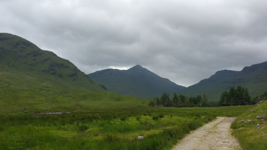
Ben Challum, seen from Glen Lochay.
Meaning - Malcolm’s Mountain
Summit Location - NN38683, 32230
Height - 1025m
Munro Number - 106
Distance - 11.6km
Total Ascent - 956m
Estimated Time - 3hrs up / 2hrs down
Difficulty - 3/5
OS Explorer Map - OL39 & OL48
Climbed - 2017
Weather - Very windy, severe windchill. Frequent rain showers, some heavy.
Ben Challum is a fairly central Munro and on a good day the views from the summit
are extensive. Parking for the main route is in a lay-by on the A82, which being
one of Scotland’s main roads makes it fairly accessible. That said the peak itself
is a fair way back from the road and therefore quite a long slog uphill. Extensive
bogs don’t make it any easier but there’s a reward of an pleasant ridge walk once
you’re up high.
The route described below is the most popular route, despite the bogs, as it offers
the quickest and shortest way to the summit. An alternative is to approach the peak
from Glen Lochay, though this makes for a fairly long walk double this distance than
if you start from Kirkton Farm. Most of this distance is covered on a farm track,
though the last few kilometers taking you too the summit is across open countryside.
At least the bogs aren’t too bad!
I opted to climb from Glen Lochay as a howling gale was blowing from the west the
day I climbed. By approaching the mountain from the east, ascending directly up via
Stob a’ Bhiora (just south of the deer fences) I would be reasonably sheltered. I’d
also avoid the ridge and spend the minimum time possible high up - a wise plan as
it was cold enough to snow. Typical June weather!
If you climb from Glen Lochay a bike could be used on the farm track - it’s reasonably
flat.
The route described below starts at Kirkton Farm as it’s shorter and easier to get
to.
Route
1 - Park in the lay-by on westbound side of the A82, just north of Kirkton Farm.
Cross the road carefully and take the lane to the farm. You’ll get to a bridge over
the River Fillan. Here you’ll join the West Highland Way for a short distance.
2 - Continue towards the farm, taking a track to the left just before reaching it.
Very soon after take a smaller track to the right, leaving the West Highland Way
and heading uphill. This track crosses the railway at a level crossing (take great
care). Soon afterwards you’ll see a faint path heading straight uphill.
3 - Continue uphill on the path, along a deer fence. It’s very boggy in places. You’ll
cross several other fences on stiles, particularly where the gradient eases for a
short while at around the 600m contour. Continue in a north-easterly direction to
reach the south ridge of the south top of Ben Challum (998m).
4 - Leave the south top heading north. Descend to a cleft which can be passed on
the west side. You’ll soon reach a col before beginning the final climb to the Munro
of Ben Challum.
5 - Return by route of ascent.